
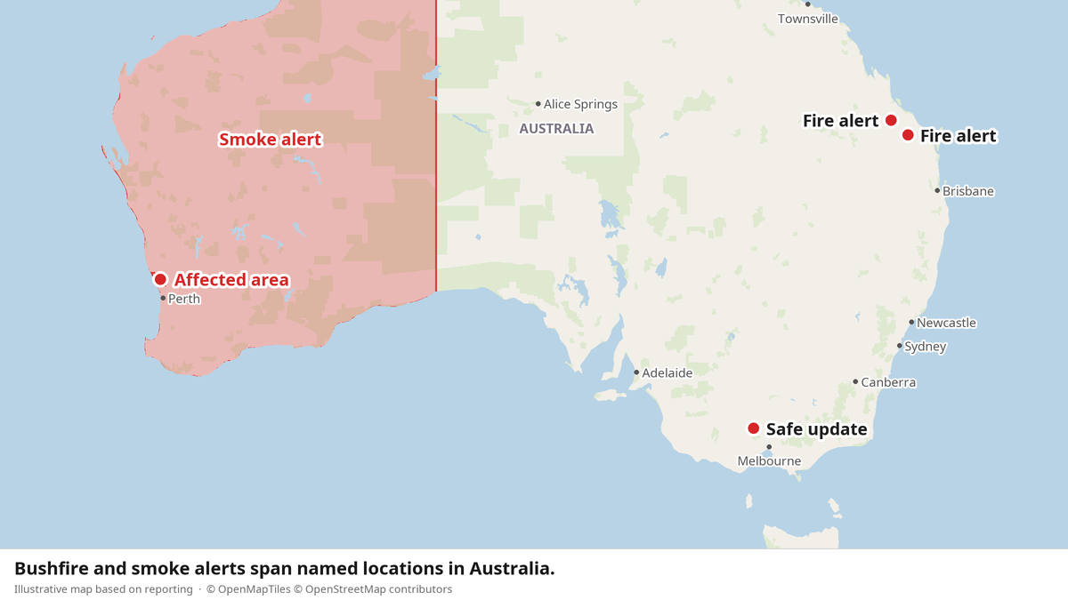
ABC Emergency issued separate fire and smoke alerts for Queensland, Victoria and Western Australia on Tuesday, October 13, 2026. Emergency agencies gave residents and motorists instructions as fires and smoke affected several regions. The notices offer no grassroots response; they spell out what people must do to manage risks from fire and smoke.
Queensland: Advice, and a list of instructions
Near Calvale Road at Valentine Plains, close to Biloela, the Queensland Fire Department said a vegetation fire was burning. Its alert sat at the Advice level, described conditions at 6:20pm and went out at 6:21:52pm AEST. The department said people should stay informed because conditions could change.
A second Advice-level alert covered a vegetation fire near Gin Gin Creek and Sawpit Road in Wonbah. It described the fire as it stood at 3:48pm Tuesday and was issued at 3:48:48pm AEST. The Queensland Fire Department told people to check updates often, listen to local radio and decide what to do if the bushfire got closer. Each household must prepare for changing conditions.
For thick smoke, the department said people should stay indoors, close windows and doors, and keep breathing medication nearby. It also told people not to fly drones near the fire because drones affect firefighting, and said anyone in danger should call Triple Zero (000). The department supplied the alert data.
The notice directed people to current Queensland Fire Department incidents and warnings, bushfire preparation tips, health and air-quality advice, updates on Facebook and X.com, and road-closure information or the number 131940. Those channels provide information; the alert doesn't describe any community-led response or shared evacuation support.
Outdated listing, continuing uncertainty
In Victoria, an ABC Emergency listing identified a bushfire 3.4 kilometres southeast of Campbells Creek. VicEmergency supplied the information. The incident appeared as “Safe,” covered 0.01 hectares and had last been updated “Today at 5:19 PM.” The update took effect from 4:30pm AEDT.
But the same listing said the incident was out of date, could still be active and may have moved to a different ID. It directed users to nearby active incidents. Residents trying to understand the risk faced both a “Safe” status and a warning that the record might no longer describe the incident accurately.
Smoke instructions for Western Australia
An active smoke alert covered Moore River State Forest, Lancelin, Ledge Point and surrounding areas, including motorists on Indian Ocean Drive and Bennies Road in the Shire of Gingin. Emergency WA said the smoke came from prescribed burning 11 kilometres east-south-east of Ledge Point and could settle in low-lying areas before clearing Wednesday morning. The alert took effect at 9:11:19am AWST.
Emergency WA advised people to shut doors and windows and turn off air-conditioners. Drivers should use headlights and drive slowly. If visibility was poor, they were told to pull over to the left, keep headlights and hazard lights on, and wait for the smoke to clear. People with asthma or pre-existing respiratory or cardiovascular illnesses should follow their pre-prepared treatment plans.
Anyone affected by smoke was told to contact a doctor or call 1800MEDICARE (1800 633 422). The alert also asked people to watch for emergency services personnel and follow their directions. The Government of Western Australia's Department of Fire and Emergency Services supplied the information. Across all three states, the official response is clear: residents must monitor alerts, make decisions and carry out the precautions themselves.