
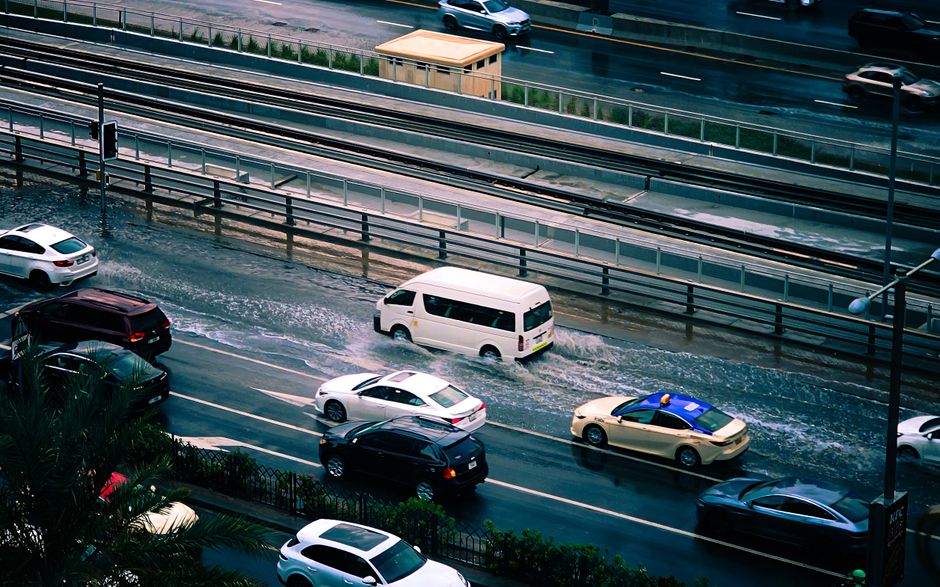
Melbourne’s Olympic Park station recorded 47.8mm of rain from 9am on Thursday, the city’s highest daily total since April 2024. Then SES phones started ringing. More than 200 calls for help came in across Victoria, including six water rescues.
The downpour was fast and heavy. Up to 25mm fell in a single hour on Thursday afternoon. Flash flooding hit parts of Melbourne, while storms and flooding struck other areas of Victoria. Around 3pm, the city plunged into darkness as the weather system moved through.
Emergency Services Respond
Six water rescues in one day. Conditions turned dangerous quickly for people caught in rising water. The State Emergency Service fielded more than 200 calls for help as flash flooding spread, and those calls didn’t come only from the city. Storms and flooding also reached other parts of Victoria.
The afternoon blackout added to the disruption. Around 3pm, the sky darkened while rain kept falling and floodwater continued to spread.
What Forecasters Say
David Crock, a senior meteorologist with the Bureau of Meteorology, put Thursday’s rainfall in context. He said the total marked Melbourne’s highest daily figure since April 2024. By October 2, 2026, two years had elapsed since the city last saw a day this wet.
His warning was blunt. “There is much more to come,” Crock said.
The Days Ahead
There’s little immediate relief in the forecast. Rain is expected across Victoria on Friday and Saturday. A flood watch remains current for catchments across much of central and eastern parts of the state, so the risk extends well beyond Thursday’s flooded areas.
Conditions should ease on Sunday as the low-pressure system moves offshore. The change is forecast to arrive from the west. Until then, communities across large parts of the state face another two days of rain on ground that’s already taken a heavy soaking.
The Bureau of Meteorology’s flood watch and the SES’s emergency response are both public services. Over the next 48 hours, they’re what Victorians will rely on as the system moves through.
Why This Matters:
Thursday’s figures show how quickly a weather system can overwhelm a city: 25mm in an hour, more than 200 calls for help, six water rescues, and a blackout by mid-afternoon. With a flood watch covering much of central and eastern Victoria and rain forecast through Saturday, the danger hasn’t passed. Public agencies carry the load in moments like this. The Bureau of Meteorology issues warnings, and the State Emergency Service answers calls. From a center-left perspective, the episode shows why those services need dependable public backing, because people facing floodwater can’t prepare for it alone. The coming days will show how well warnings reach communities in the flood watch area.